| 
|
|
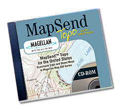
MapSend
Topo USA™
Enabling
tourists, motorists and outdoor enthusiasts to maximize the potential
of their GPS technology, the MapSend Topo USA CD provides the capability
to download highly detailed maps into your Meridian™ and MAP 330
family of products. These maps include detailed topography maps, trails,
streets, rivers, lakes, coastlines, and recreation points of interest
for the entire United States. Map sizes and regions are user selectable
and can be customized to meet your needs. Also, create waypoints and routes
and then download them directly into your Meridian or MAP 330 for use
in the field or save them to your PC. Download your tracks from your GPS
handheld to view on Map. Helps plot your current position on detailed
map. Use Search function to easily find topography, trails, street addresses,
cities, lakes and waterways, parks, airports, campgrounds, geysers, falls,
towers, caves, mines, summits, dams, bridges and more.
Helping
You Be Prepared
Our topography is derived from the US Government's Digital Elevation Model
(DEM). This allows elevation readouts for every location on the map for
both the PC and Magellan receiver. You will find that MapSend Topo USA
makes an excellent trip planning tool — helping you know what is
in store for you before you even leave camp.
|
