|
|
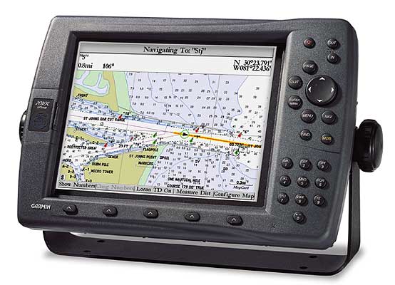
GPSMAP 2010 The GPSMAP 2010 and GPSMAP 2010C (shown) are works of art in their own right. These full-featured chartplotters boast 10-inch screens with either a 10-level grayscale or 256-color display. You'll be amazed at the exceptional resolution and extremely fast redraw and response time. Designed for use above deck or at the navstation, these chartplotters are waterproof and easy to read, even in sunlight. Their smart antennas have built-in WAAS receivers, which deliver position accuracy to within three meters (on average). Both units have a worldwide basemap with excellent coastline detail and accept up to two optional data cards with GARMIN's exclusive BlueChart™ cartography. The GPSMAP 2010 is also compatible with many MapSource™ CD-ROM products, including Fishing Hot Spots. Blue Charts are located here: CHARTS
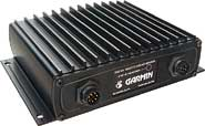
Accessories Included with GPSMAP 2010 Packages One Year Factory warranty GPS 17N external remote sensor (antenna) Power/data cable Bail mount Template for flush mounting Protective front cover Owner’s manual Quick reference guide Blue Charts are located here: CHARTS Turn your GPSMAP 2010 into a dual purpose GPS/Fishfinder with the GSD 20 (Black Box). Just click here: GSD 20 
Suggested Retail Price Our Price: $1,850.00 |
||||||||||||||||
Popular Accessories | ||||
A/C Adapters | ||||
| Part # | Accessory Description | Our Price | Purchase | |
| 010-10276-00 | A/C-PC Adapter | $45.00 | ||
Antennas | ||||
| Part # | Accessory Description | Our Price | Purchase | |
Bracket Mounts | ||||
| Part # | Accessory Description | Our Price | Purchase | |
Power and Cables | ||||
| Part # | Accessory Description | Our Price | Purchase | |
Data Cards | ||||
| Part # | Accessory Description | Our Price | Purchase | |
| 010-10226-02 | Blank 64MB Memory Cartridge | $94.95 | ||
| 010-10226-01 | Blank 32MB Memory Cartridge | $64.95 | ||
| 010-10226-00 | Blank 16MB Memory Cartridge | $50.00 | ||
| 010-10227-00 | Blank 8MB Memory Cartridge | $39.00 | ||
| 010-00210-00 | USB Data Card Programmer | $60.00 | ||
MapSource Software | ||||
| Part # | Accessory Description | Our Price | Purchase | |
| 010-10215-03 | Garmin US MetroGuide v 4.0x CD Rom | $79.00 | ||
| 010-10215-02 | Garmin US Topo CD ROM | $79.00 | ||
| 010-10215-00 | Garmin US Roads and Rec. CD Rom | $79.00 | ||
| 010-10215-01 | Garmin World Map CD ROM | $89.00 | ||
| 010-10215-05 | US Waterways & Lights | $69.00 | ||
| 010-10215-06 | Canada MetroGuide and Roads and Rec. | $89.00 | ||
Misc | ||||
| Part # | Accessory Description | Our Price | Purchase | |
