|
|
|
|

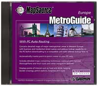
MetroGuide Europe
 Please note: The trip and waypoint management functions of this product work with nearly all GARMIN GPS units, excluding the GPS100 family and panel mount aviation units.
Map download specifications: MetroGuide map detail can be downloaded to the StreetPilot, StreetPilot ColorMap, eMap and GPSMAP 295 which require a GARMIN data card. Roads and Recreation map detail can be downloaded to the GPS III+, GPS 12Map, NavTalk, GPSMAP 162 and GPSMAP 168 Sounder.
All of our European MetroGuides have now been combined and updated into this single MetroGuide Europe CD which covers all of Western Europe. In addition to the updated map data, we've added enhanced features such as automatic routing capabilities on the PC.
MetroGuide Europe is now updated to include: Updated map data and expanded coverage to include countries never offered in previous releases. Detailed maps of Western Europe, with business and residential street names and address lookup capability on the PC before downloading to a compatible unit with address lookup feature. Map detail contains attributes for automatic routing on the PC. Detailed maps containing motorways, national and regional thoroughfares, and local roads, plus other navigation features. Plus points of interest, such as food and drink, lodging, border crossings, petrol stations, hospitals and more.
Suggested Retail Price $175
Our Price: $125.00
|
|
